| Item Detail |
| |
| |
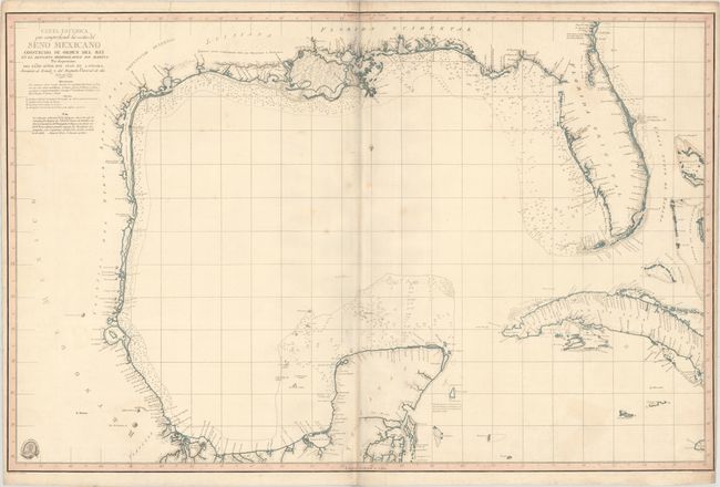
MapMaker: |
Direccion de Hidrografia
|
|
| |
| |
Subject: |
Gulf of Mexico, Texas |
|
| |
Period/Size: |
1803 / 23.9" x 36.5" (60.7 x 92.8 cm)
|
|
| |
Color: |
Colored
|
|
| |
Condition: |
(B+) Old color with minor soiling and a few faint stains. There is an extraneous crease adjacent to the centerfold and a printer's crease at top (to the right of the title) that has been archivally reinforced on verso. There are a few spots of foxing an (condition help) |
|
| |
Source: |
|
|
| |
References: |
Streeter (Part III) p. xv and #1029A; Martin & Martin, p. 105. |
|
| |
|
|
| Sales Information |
| |
| |
Price: |
|
|
| |
| |
Offered by: |
Old World Auctions |
|
| |
Catalog: |
Auction No. 171 - Antique Maps, Charts, Atlases & Globes (9469) |
|
| |
Lot/Item #: |
344 |
|
| |
| |
Date: |
02/2019
|
|
| |
| |
|