Title:
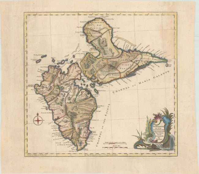
“Guadaloupe One of the Caribbee Islands Subject to France in the West Indies, from the Best Authorities”
Map Maker:
Thomas Jefferys
This uncommon map focuses on the various parishes ... (full text available to subscribers)
| Item Detail |
| |
| |
MapMaker: |
Thomas Jefferys
|
|
| |
| |
Subject: |
Guadeloupe |
|
| |
Period/Size: |
1768 / 13.6" x 14.4" (34.6 x 36.6 cm)
|
|
| |
Color: |
Colored
|
|
| |
Condition: |
(B+) Contemporary color in the map with later color in the cartouche and light soiling that is more pronounced at top right. There are archival repairs to centerfold separations at top and bottom and to 4 short tears in the blank margins, one of which ju (condition help) |
|
| |
Source: |
General Topography of North America and the West Indies |
|
| |
References: |
Shirley (BL Atlases) T.JEF-1a. |
|
| |
|
|
| Sales Information |
| |
| |
Price: |
|
|
| |
| |
Offered by: |
Old World Auctions |
|
| |
Catalog: |
Auction No. 171 - Antique Maps, Charts, Atlases & Globes (9469) |
|
| |
Lot/Item #: |
368 |
|
| |
| |
Date: |
02/2019
|
|
| |
| |
|
Antique Maps - Valuation and Pricing, Descriptions, Resources |
|
Home |
Information |
Search |
Register |
Contact Us |
Site Map
Americana Exchange, Inc. © 1999 - 2024 Americana Exchange, Inc.. All rights reserved.
OldMaps.com, the OldMaps.com logo and
AMPR are service marks or registered service marks of Americana Exchange, Inc..
|