Title:
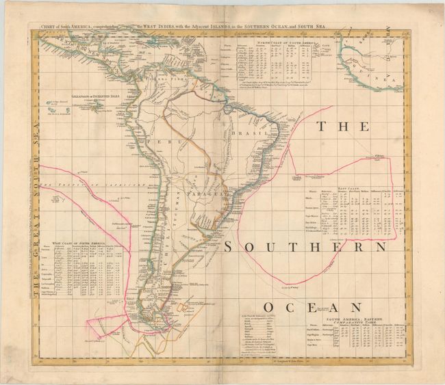
“Chart of South America, Comprehending the West Indies, with the Adjacent Islands, in the Southern Ocean, and South Sea”
Map Maker:
Thomas Jefferys
This is sheet VI of a six-sheet map of the western... (full text available to subscribers)
| Item Detail |
| |
| |
MapMaker: |
Thomas Jefferys
|
|
| |
| |
Subject: |
South America |
|
| |
Period/Size: |
1753 / 21.3" x 24.0" (54.1 x 61.0 cm)
|
|
| |
Color: |
Colored
|
|
| |
Condition: |
(B) On a watermarked sheet with light soiling and a number of separations and short tears along the centerfold that have been closed on verso with tape. (condition help) |
|
| |
Source: |
|
|
| |
References: |
Ristow pp. 31-32; Schwartz & Erhrenberg, p.158-59; Stevens & Tree #4-Sheet VI. |
|
| |
|
|
| Sales Information |
| |
| |
Price: |
|
|
| |
| |
Offered by: |
Old World Auctions |
|
| |
Catalog: |
Auction No. 171 - Antique Maps, Charts, Atlases & Globes (9469) |
|
| |
Lot/Item #: |
380 |
|
| |
| |
Date: |
02/2019
|
|
| |
| |
|
Antique Maps - Valuation and Pricing, Descriptions, Resources |
|
Home |
Information |
Search |
Register |
Contact Us |
Site Map
Americana Exchange, Inc. © 1999 - 2024 Americana Exchange, Inc.. All rights reserved.
OldMaps.com, the OldMaps.com logo and
AMPR are service marks or registered service marks of Americana Exchange, Inc..
|