Title:
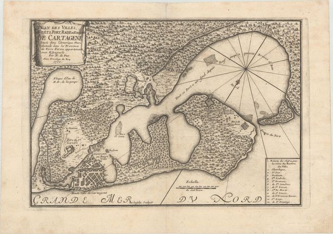
“Plan des Villes, Forts, Port, Rade et Environ de Cartagene Situee dans l'Amerique Meridionale dans la Province de Terre Ferme Appartenant aux Espagnols”
Map Maker:
Nicolas de Fer
This map of Cartagena and the surrounding bay depi... (full text available to subscribers)
| Item Detail |
| |
| |
MapMaker: |
Nicolas de Fer
|
|
| |
| |
Subject: |
Cartagena, Colombia |
|
| |
Period/Size: |
1700 / 8.7" x 12.6" (22.1 x 32.0 cm)
|
|
| |
Color: |
Black & White
|
|
| |
Condition: |
(A) A dark impression on watermarked paper with marginal soiling and a an archivally repaired centerfold separation confined to the top blank margin. (condition help) |
|
| |
Source: |
L'Atlas Curieux ou le Monde... |
|
| |
References: |
Kapp (MCC-77) #39; Pastoureau, FER I A [22]. |
|
| |
|
|
| Sales Information |
| |
| |
Price: |
|
|
| |
| |
Offered by: |
Old World Auctions |
|
| |
Catalog: |
Auction No. 171 - Antique Maps, Charts, Atlases & Globes (9469) |
|
| |
Lot/Item #: |
390 |
|
| |
| |
Date: |
02/2019
|
|
| |
| |
|
Antique Maps - Valuation and Pricing, Descriptions, Resources |
|
Home |
Information |
Search |
Register |
Contact Us |
Site Map
Americana Exchange, Inc. © 1999 - 2024 Americana Exchange, Inc.. All rights reserved.
OldMaps.com, the OldMaps.com logo and
AMPR are service marks or registered service marks of Americana Exchange, Inc..
|