| Item Detail |
| |
| |
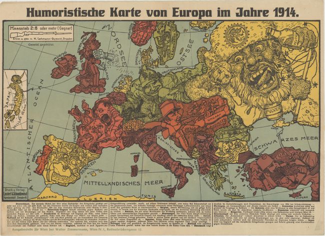
MapMaker: |
Leutert & Schneiderwind
|
|
| |
| |
Subject: |
Europe, World War I |
|
| |
Period/Size: |
1914 / 10.9" x 19.1" (27.7 x 48.6 cm)
|
|
| |
Color: |
Colored
|
|
| |
Condition: |
(A) Bold color with minor soiling just south of Italy and along the edges of the sheet. Several of the folds have been archivally reinforced on verso, repairing some minor separations and tiny holes along the folds. There are a few small pin holes in th (condition help) |
|
| |
Source: |
|
|
| |
References: |
Curtis & Pederson (War Map) pp. 32-35; PJ Mode Collection #1174.01. |
|
| |
|
|
| Sales Information |
| |
| |
Price: |
|
|
| |
| |
Offered by: |
Old World Auctions |
|
| |
Catalog: |
Auction No. 171 - Antique Maps, Charts, Atlases & Globes (9469) |
|
| |
Lot/Item #: |
432 |
|
| |
| |
Date: |
02/2019
|
|
| |
| |
|