Title:
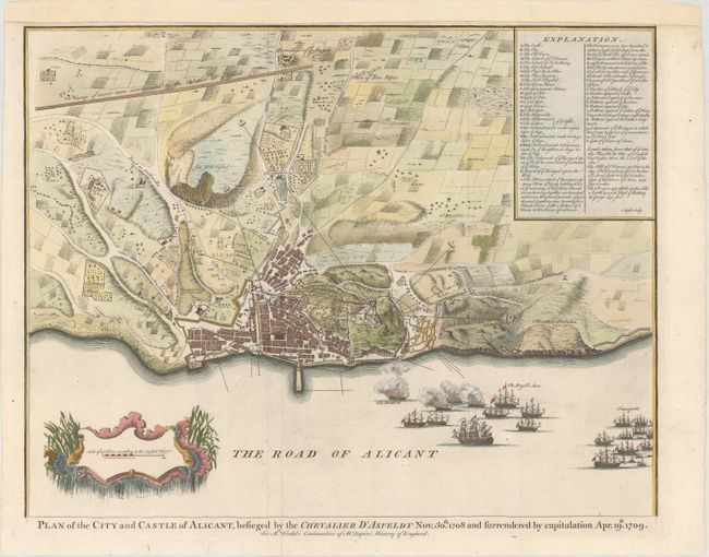
“Plan of the City and Castle of Alicant, Besieged by the Chevalier d'Asfeldt Nov. 30th 1708 and Surrendered by Capitulation Apr. 19th 1709”
Map Maker:
Paul Rapin de Thoyras
Detailed plan of this Spanish Mediterranean city, ... (full text available to subscribers)
| Item Detail |
| |
| |
MapMaker: |
Paul Rapin de Thoyras
|
|
| |
| |
Subject: |
Alicante, Spain |
|
| |
Period/Size: |
1745 / 14.3" x 18.4" (36.4 x 46.8 cm)
|
|
| |
Color: |
Colored
|
|
| |
Condition: |
(B+) Issued folding, now pressed, on watermarked paper with a few minor creases and archival repairs to a fold separation and adjacent 1/2" tear in blank area of image at bottom. Top margin extended with old paper to accommodate framing. (condition help) |
|
| |
Source: |
Mr. Tindal's Continuation of Mr. Rapin's History of England |
|
| |
References: |
Shirley (BL Atlases) G.RAP-1a #32. |
|
| |
|
|
| Sales Information |
| |
| |
Price: |
|
|
| |
| |
Offered by: |
Old World Auctions |
|
| |
Catalog: |
Auction No. 171 - Antique Maps, Charts, Atlases & Globes (9469) |
|
| |
Lot/Item #: |
514 |
|
| |
| |
Date: |
02/2019
|
|
| |
| |
|
Antique Maps - Valuation and Pricing, Descriptions, Resources |
|
Home |
Information |
Search |
Register |
Contact Us |
Site Map
Americana Exchange, Inc. © 1999 - 2024 Americana Exchange, Inc.. All rights reserved.
OldMaps.com, the OldMaps.com logo and
AMPR are service marks or registered service marks of Americana Exchange, Inc..
|