| Item Detail |
| |
| |
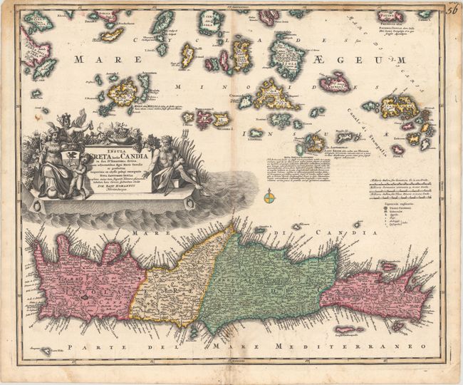
MapMaker: |
Johann Baptist Homann
|
|
| |
| |
Subject: |
Crete |
|
| |
Period/Size: |
1730 / 18.8" x 22.4" (47.8 x 56.9 cm)
|
|
| |
Color: |
Colored
|
|
| |
Condition: |
(B+) A superb, dark impression with contemporary color on a watermarked sheet. There is light toning along the centerfold, some soiling primarily at bottom center and in the border at top, and archival repairs to short centerfold separations at top and b (condition help) |
|
| |
Source: |
|
|
| |
References: |
|
|
| |
|
|
| Sales Information |
| |
| |
Price: |
|
|
| |
| |
Offered by: |
Old World Auctions |
|
| |
Catalog: |
Auction No. 171 - Antique Maps, Charts, Atlases & Globes (9469) |
|
| |
Lot/Item #: |
613 |
|
| |
| |
Date: |
02/2019
|
|
| |
| |
|