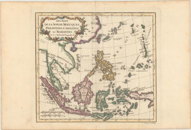
Title:
“Les Isles de la Sonde, Moluques, Philippines, Carolines, et Mariannes”
Map Maker:
Didier Robert de Vaugondy
This striking map extends from eastern China south... (full text available to subscribers)
| Item Detail |
| |
| |
MapMaker: |
Didier Robert de Vaugondy
|
|
| |
| |
Subject: |
Southeast Asia |
|
| |
Period/Size: |
1778 / 9.4" x 10.4" (23.9 x 26.5 cm)
|
|
| |
Color: |
Colored
|
|
| |
Condition: |
(B+) A dark impression on a watermarked sheet with a few faint spots and light soiling that is mostly concentrated in the blank margins. (condition help) |
|
| |
Source: |
Nouvel Atlas Portatif |
|
| |
References: |
Pedley #415. |
|
| |
|
|
| Sales Information |
| |
| |
Price: |
|
|
| |
| |
Offered by: |
Old World Auctions |
|
| |
Catalog: |
Auction No. 171 - Antique Maps, Charts, Atlases & Globes (9469) |
|
| |
Lot/Item #: |
685 |
|
| |
| |
Date: |
02/2019
|
|
| |
| |
|
Antique Maps - Valuation and Pricing, Descriptions, Resources |
|
Home |
Information |
Search |
Register |
Contact Us |
Site Map
Americana Exchange, Inc. © 1999 - 2024 Americana Exchange, Inc.. All rights reserved.
OldMaps.com, the OldMaps.com logo and
AMPR are service marks or registered service marks of Americana Exchange, Inc..
|