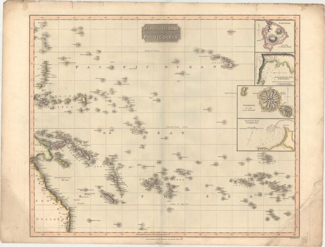
Title:
“Map of the Islands in the Pacific Ocean”
Map Maker:
John Thomson [& Co.]
This detailed map features some of the islands of ... (full text available to subscribers)
| Item Detail |
| |
| |
MapMaker: |
John Thomson [& Co.]
|
|
| |
| |
Subject: |
Pacific Islands |
|
| |
Period/Size: |
1817 / 19.4" x 23.5" (49.3 x 59.7 cm)
|
|
| |
Color: |
Colored
|
|
| |
Condition: |
(B) Light surface soiling with an edge tear in the bottom right corner of the sheet that extends approximately 1" into the image that has been closed on verso with archival tape. There are a number of short edge tears confined to the top blank margin. (condition help) |
|
| |
Source: |
New General Atlas |
|
| |
References: |
|
|
| |
|
|
| Sales Information |
| |
| |
Price: |
|
|
| |
| |
Offered by: |
Old World Auctions |
|
| |
Catalog: |
Auction No. 171 - Antique Maps, Charts, Atlases & Globes (9469) |
|
| |
Lot/Item #: |
732 |
|
| |
| |
Date: |
02/2019
|
|
| |
| |
|
Antique Maps - Valuation and Pricing, Descriptions, Resources |
|
Home |
Information |
Search |
Register |
Contact Us |
Site Map
Americana Exchange, Inc. © 1999 - 2024 Americana Exchange, Inc.. All rights reserved.
OldMaps.com, the OldMaps.com logo and
AMPR are service marks or registered service marks of Americana Exchange, Inc..
|