| Item Detail |
| |
| |
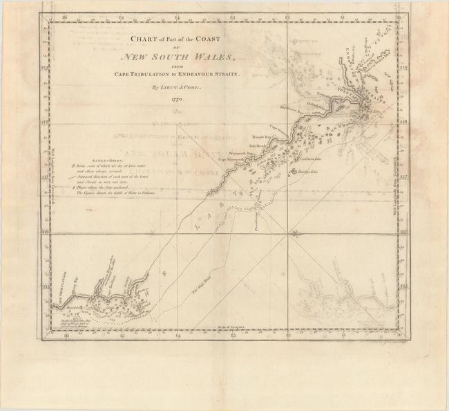
MapMaker: |
James Cook
|
|
| |
| |
Subject: |
Northeastern Australia |
|
| |
Period/Size: |
1773 / 11.8" x 13.3" (30.0 x 33.8 cm)
|
|
| |
Color: |
Black & White
|
|
| |
Condition: |
(B) Issued folding on watermarked paper with moderate offsetting and light dampstains. (condition help) |
|
| |
Source: |
Account of the Voyages Undertaken...in the Southern Hemisphere |
|
| |
References: |
Tooley (Australia) #327; Shirley (BL Atlases) G.HAWK-1a #27. |
|
| |
|
|
| Sales Information |
| |
| |
Price: |
|
|
| |
| |
Offered by: |
Old World Auctions |
|
| |
Catalog: |
Auction No. 171 - Antique Maps, Charts, Atlases & Globes (9469) |
|
| |
Lot/Item #: |
735 |
|
| |
| |
Date: |
02/2019
|
|
| |
| |
|