| Item Detail |
| |
| |
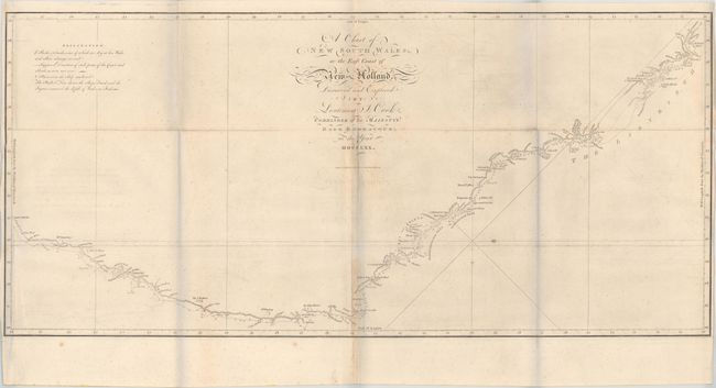
MapMaker: |
James Cook
|
|
| |
| |
Subject: |
Eastern Australia |
|
| |
Period/Size: |
1773 / 14.3" x 30.9" (36.4 x 78.5 cm)
|
|
| |
Color: |
Black & White
|
|
| |
Condition: |
(B+) Issued folding on watermarked paper with light offsetting, faint scattered foxing, and light toning along the middle fold. Side margins are narrow, but still adequate for framing. (The bluish hue along the fold lines in the image is caused by our s (condition help) |
|
| |
Source: |
Account of the Voyages Undertaken...in the Southern Hemisphere |
|
| |
References: |
Tooley (Australia) #325; Shirley (BL Atlases) G.HAWK-1a #26. |
|
| |
|
|
| Sales Information |
| |
| |
Price: |
|
|
| |
| |
Offered by: |
Old World Auctions |
|
| |
Catalog: |
Auction No. 171 - Antique Maps, Charts, Atlases & Globes (9469) |
|
| |
Lot/Item #: |
736 |
|
| |
| |
Date: |
02/2019
|
|
| |
| |
|