Title:
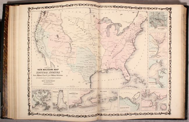
“Johnson's New Illustrated (Steel Plate) Family Atlas, with Descriptions, Geographical, Statistical, and Historical”
Map Maker:
Johnson & Browning
This popular atlas is complete with 31 single-page... (full text available to subscribers)
| Item Detail |
| |
| |
MapMaker: |
Johnson & Browning
|
|
| |
| |
Subject: |
Atlases, World |
|
| |
Period/Size: |
1861 / 18.7" x 15.0" (47.5 x 38.1 cm)
|
|
| |
Color: |
Colored
|
|
| |
Condition: |
(B+) The maps are overall very good with pleasant light toning and occasional faint offsetting. The maps of North/South Carolina and Kentucky/Tennessee are moderately toned, and the world map on Mercator's Projection has a small worm track along the lowe (condition help) |
|
| |
Source: |
|
|
| |
References: |
|
|
| |
|
|
| Sales Information |
| |
| |
Price: |
|
|
| |
| |
Offered by: |
Old World Auctions |
|
| |
Catalog: |
Auction No. 171 - Antique Maps, Charts, Atlases & Globes (9469) |
|
| |
Lot/Item #: |
758 |
|
| |
| |
Date: |
02/2019
|
|
| |
| |
|
Antique Maps - Valuation and Pricing, Descriptions, Resources |
|
Home |
Information |
Search |
Register |
Contact Us |
Site Map
Americana Exchange, Inc. © 1999 - 2024 Americana Exchange, Inc.. All rights reserved.
OldMaps.com, the OldMaps.com logo and
AMPR are service marks or registered service marks of Americana Exchange, Inc..
|