Title:
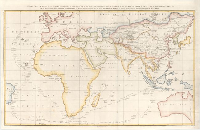
“A General Chart, on Mercator's Projection, to Shew the Track of the Lion and Hindostan from England to the Gulph of Pekin in China...”
Map Maker:
Sir John Barrow
This large chart was part of an account of George ... (full text available to subscribers)
| Item Detail |
| |
| |
MapMaker: |
Sir John Barrow
|
|
| |
| |
Subject: |
Eastern Hemisphere |
|
| |
Period/Size: |
1796 / 22.3" x 36.7" (56.7 x 93.3 cm)
|
|
| |
Color: |
Colored
|
|
| |
Condition: |
(A) An excellent impression, issued folding on a bright sheet with a "J. Whatman 1794" watermark. There are a few small, unobtrusive spots of soiling near the bottom of the image. (condition help) |
|
| |
Source: |
An Authentic Account of an Embassy from the King of Great Britainģ |
|
| |
References: |
Shirley (BL Atlases) G.BARR-1a #1. |
|
| |
|
|
| Sales Information |
| |
| |
Price: |
|
|
| |
| |
Offered by: |
Old World Auctions |
|
| |
Catalog: |
Auction No. 172 - Antique Maps, Charts, Atlases & Globes (9470) |
|
| |
Lot/Item #: |
40 |
|
| |
| |
Date: |
04/2019
|
|
| |
| |
|
Antique Maps - Valuation and Pricing, Descriptions, Resources |
|
Home |
Information |
Search |
Register |
Contact Us |
Site Map
Americana Exchange, Inc. © 1999 - 2024 Americana Exchange, Inc.. All rights reserved.
OldMaps.com, the OldMaps.com logo and
AMPR are service marks or registered service marks of Americana Exchange, Inc..
|