| Item Detail |
| |
| |
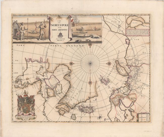
MapMaker: |
Moses Pitt
|
|
| |
| |
Subject: |
North Pole |
|
| |
Period/Size: |
1680 / 18.0" x 23.1" (45.8 x 58.7 cm)
|
|
| |
Color: |
Colored
|
|
| |
Condition: |
(B) A nice impression in contemporary color with a number of small cracks due to the oxidation of the green pigment (now mostly tan) that have been professionally repaired on verso. A tiny chip in the dedication cartouche has been replaced in facsimile. (condition help) |
|
| |
Source: |
The English Atlas |
|
| |
References: |
Shirley (BL Atlases) T.PITT-1a #3; Kershaw #120. |
|
| |
|
|
| Sales Information |
| |
| |
Price: |
|
|
| |
| |
Offered by: |
Old World Auctions |
|
| |
Catalog: |
Auction No. 172 - Antique Maps, Charts, Atlases & Globes (9470) |
|
| |
Lot/Item #: |
42 |
|
| |
| |
Date: |
04/2019
|
|
| |
| |
|