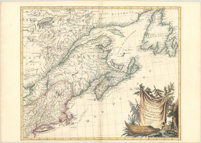
Title:
“Partie Orientale du Canada, avec la Nouvelle Angleterre, l'Acadie, et la Terre-Neuve”
Map Maker:
Anville/Santini
This large, attractive map covers New England, the... (full text available to subscribers)
| Item Detail |
| |
| |
MapMaker: |
Anville/Santini
|
|
| |
| |
Subject: |
Colonial Northeastern United States & Canada |
|
| |
Period/Size: |
1776 / 19.1" x 22.9" (48.6 x 58.2 cm)
|
|
| |
Color: |
Colored
|
|
| |
Condition: |
(B+) A nice impression on a bright sheet with an "Imperial VO" watermark and light toning along the centerfold, minor offsetting, and an archivally repaired centerfold separation that enters 2" into image at bottom. (condition help) |
|
| |
Source: |
Atlas Universel... |
|
| |
References: |
Kershaw #714; McCorkle #776.4; Phillips (A) #647-47; Sellers & Van Ee #138. |
|
| |
|
|
| Sales Information |
| |
| |
Price: |
|
|
| |
| |
Offered by: |
Old World Auctions |
|
| |
Catalog: |
Auction No. 172 - Antique Maps, Charts, Atlases & Globes (9470) |
|
| |
Lot/Item #: |
107 |
|
| |
| |
Date: |
04/2019
|
|
| |
| |
|
Antique Maps - Valuation and Pricing, Descriptions, Resources |
|
Home |
Information |
Search |
Register |
Contact Us |
Site Map
Americana Exchange, Inc. © 1999 - 2024 Americana Exchange, Inc.. All rights reserved.
OldMaps.com, the OldMaps.com logo and
AMPR are service marks or registered service marks of Americana Exchange, Inc..
|