| Item Detail |
| |
| |
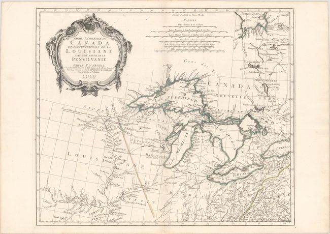
MapMaker: |
Anville/Santini
|
|
| |
| |
Subject: |
Colonial Central United States & Canada, Great Lakes |
|
| |
Period/Size: |
1775 / 19.0" x 22.6" (48.3 x 57.4 cm)
|
|
| |
Color: |
Colored
|
|
| |
Condition: |
(A) A dark impression on a bright sheet of watermarked paper with contemporary outline color. There are a few tiny centerfold separations at bottom closed on verso with archival material. (condition help) |
|
| |
Source: |
Atlas Universel... |
|
| |
References: |
Kershaw #978; Phillips (A) #647-46; Tooley (Amer) p. 317. |
|
| |
|
|
| Sales Information |
| |
| |
Price: |
|
|
| |
| |
Offered by: |
Old World Auctions |
|
| |
Catalog: |
Auction No. 172 - Antique Maps, Charts, Atlases & Globes (9470) |
|
| |
Lot/Item #: |
111 |
|
| |
| |
Date: |
04/2019
|
|
| |
| |
|