Title:
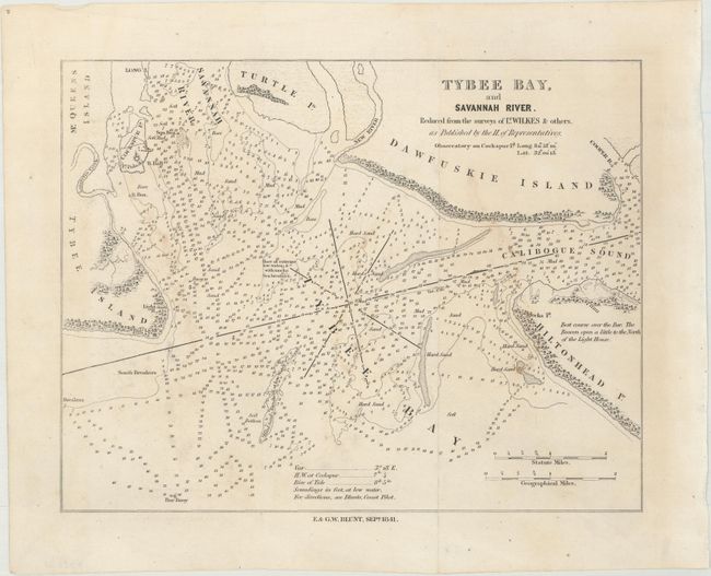
“Tybee Bay, and Savannah River. Reduced from the Surveys of Lt. Wilkes & Others...”
Map Maker:
Blunt [Family]
This small chart from Edmund and George W. Blunt's... (full text available to subscribers)
| Item Detail |
| |
| |
MapMaker: |
Blunt [Family]
|
|
| |
| |
Subject: |
Georgia & South Carolina |
|
| |
Period/Size: |
1841 / 7.4" x 9.8" (18.8 x 24.9 cm)
|
|
| |
Color: |
Black & White
|
|
| |
Condition: |
(B+) Issued folding with a few faint stains. (condition help) |
|
| |
Source: |
The American Coast Pilot |
|
| |
References: |
|
|
| |
|
|
| Sales Information |
| |
| |
Price: |
|
|
| |
| |
Offered by: |
Old World Auctions |
|
| |
Catalog: |
Auction No. 172 - Antique Maps, Charts, Atlases & Globes (9470) |
|
| |
Lot/Item #: |
153 |
|
| |
| |
Date: |
04/2019
|
|
| |
| |
|
Antique Maps - Valuation and Pricing, Descriptions, Resources |
|
Home |
Information |
Search |
Register |
Contact Us |
Site Map
Americana Exchange, Inc. © 1999 - 2024 Americana Exchange, Inc.. All rights reserved.
OldMaps.com, the OldMaps.com logo and
AMPR are service marks or registered service marks of Americana Exchange, Inc..
|