Title:
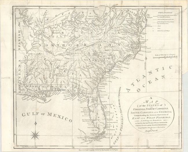
“A Map of the States of Virginia, North Carolina, South Carolina and Georgia; Comprehending the Spanish Provinces of East and West Florida...”
Map Maker:
Joseph Purcell
This fine map is a fascinating historical document... (full text available to subscribers)
| Item Detail |
| |
| |
MapMaker: |
Joseph Purcell
|
|
| |
| |
Subject: |
Southern United States, Franklin |
|
| |
Period/Size: |
1792 / 12.6" x 14.4" (32.0 x 36.6 cm)
|
|
| |
Color: |
Black & White
|
|
| |
Condition: |
(B+) A dark impression on a bright sheet with a number of small fold separations and a short binding tear at right that have all been closed on verso with archival tape. Two tiny areas of loss along the left border have been redrawn in facsimile. Issued (condition help) |
|
| |
Source: |
Morse's American Geography |
|
| |
References: |
Dotson & Baker (OWA) #6; Baynton-Williams (TMC-72) p. 16, #4; McCorkle (18th C. Geography Books) #300-1. |
|
| |
|
|
| Sales Information |
| |
| |
Price: |
|
|
| |
| |
Offered by: |
Old World Auctions |
|
| |
Catalog: |
Auction No. 172 - Antique Maps, Charts, Atlases & Globes (9470) |
|
| |
Lot/Item #: |
156 |
|
| |
| |
Date: |
04/2019
|
|
| |
| |
|
Antique Maps - Valuation and Pricing, Descriptions, Resources |
|
Home |
Information |
Search |
Register |
Contact Us |
Site Map
Americana Exchange, Inc. © 1999 - 2024 Americana Exchange, Inc.. All rights reserved.
OldMaps.com, the OldMaps.com logo and
AMPR are service marks or registered service marks of Americana Exchange, Inc..
|