Title:
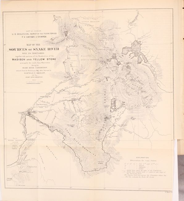
“Sixth Annual Report of the United States Geological Survey of the Territories, Embracing Portions of Montana, Idaho, Wyoming, and Utah...”
Map Maker:
Ferdinand Vandeveer Hayden
This report focuses on the territories of Montana,... (full text available to subscribers)
| Item Detail |
| |
| |
MapMaker: |
Ferdinand Vandeveer Hayden
|
|
| |
| |
Subject: |
Exploration, Western United States |
|
| |
Period/Size: |
1873 / 9.1" x 5.8" (23.2 x 14.8 cm)
|
|
| |
Color: |
Black & White
|
|
| |
Condition: |
(B+) The maps have minor toning. The map of Snake River has a binding trim at bottom right that extends into the border, and the map of the Shoshone Geysers has a 1/2" binding tear at left and a short fold separation. The text is lightly toned and a bit (condition help) |
|
| |
Source: |
|
|
| |
References: |
Blevins #238; cf. Wheat #1233. |
|
| |
|
|
| Sales Information |
| |
| |
Price: |
|
|
| |
| |
Offered by: |
Old World Auctions |
|
| |
Catalog: |
Auction No. 172 - Antique Maps, Charts, Atlases & Globes (9470) |
|
| |
Lot/Item #: |
176 |
|
| |
| |
Date: |
04/2019
|
|
| |
| |
|
Antique Maps - Valuation and Pricing, Descriptions, Resources |
|
Home |
Information |
Search |
Register |
Contact Us |
Site Map
Americana Exchange, Inc. © 1999 - 2024 Americana Exchange, Inc.. All rights reserved.
OldMaps.com, the OldMaps.com logo and
AMPR are service marks or registered service marks of Americana Exchange, Inc..
|