Title:
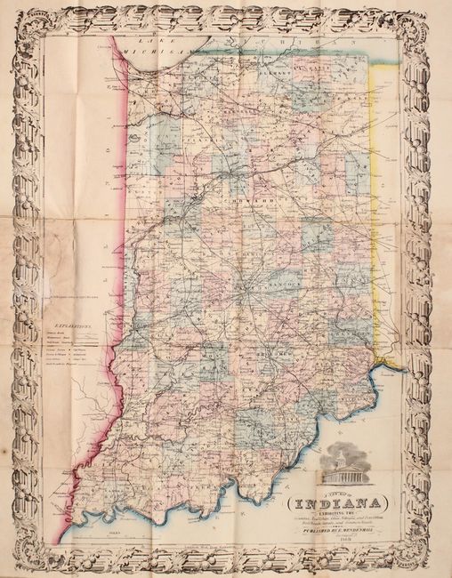
“A New Map of Indiana Exhibiting the Counties, Townships, Cities, Villages, and Post Offices. Rail Roads, Canals, and Common Roads”
Map Maker:
Mendenhall
An attractive, uncommon map of the state showing c... (full text available to subscribers)
| Item Detail |
| |
| |
MapMaker: |
Mendenhall
|
|
| |
| |
Subject: |
Indiana |
|
| |
Period/Size: |
1869 / 20.6" x 15.2" (52.4 x 38.6 cm)
|
|
| |
Color: |
Colored
|
|
| |
Condition: |
(B) Issued folding with light staining primarily where the map folds into its covers. A series of small tears near where the map was glued to the rear board have been closed with archival material. Coves are very good. (condition help) |
|
| |
Source: |
|
|
| |
References: |
|
|
| |
|
|
| Sales Information |
| |
| |
Price: |
|
|
| |
| |
Offered by: |
Old World Auctions |
|
| |
Catalog: |
Auction No. 172 - Antique Maps, Charts, Atlases & Globes (9470) |
|
| |
Lot/Item #: |
227 |
|
| |
| |
Date: |
04/2019
|
|
| |
| |
|
Antique Maps - Valuation and Pricing, Descriptions, Resources |
|
Home |
Information |
Search |
Register |
Contact Us |
Site Map
Americana Exchange, Inc. © 1999 - 2024 Americana Exchange, Inc.. All rights reserved.
OldMaps.com, the OldMaps.com logo and
AMPR are service marks or registered service marks of Americana Exchange, Inc..
|