| Item Detail |
| |
| |
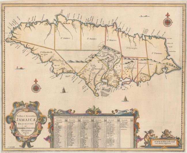
MapMaker: |
John Ogilby
|
|
| |
| |
Subject: |
Jamaica |
|
| |
Period/Size: |
1671 / 17.2" x 21.1" (43.7 x 53.6 cm)
|
|
| |
Color: |
Colored
|
|
| |
Condition: |
(B) Issued folding, now pressed, on watermarked paper with attractive color and professional repairs to several tiny holes and short tears along the fold within the table at bottom. Chips at left and bottom right have been expertly repaired with the imag (condition help) |
|
| |
Source: |
America: Being the Latest, and Most Accurate Description of the New World... |
|
| |
References: |
Kapp (MCC-42) #13; Shirley (BL Atlases) T.OGIL-2a #23. |
|
| |
|
|
| Sales Information |
| |
| |
Price: |
|
|
| |
| |
Offered by: |
Old World Auctions |
|
| |
Catalog: |
Auction No. 172 - Antique Maps, Charts, Atlases & Globes (9470) |
|
| |
Lot/Item #: |
319 |
|
| |
| |
Date: |
04/2019
|
|
| |
| |
|