Title:
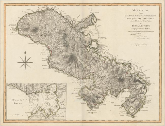
“Martinico, Done from Actual Surveys and Observations, Made by English Engineers Whilst the Island Was in Their Possession”
Map Maker:
Jefferys/Laurie & Whittle
This map was prepared by English engineers when Ma... (full text available to subscribers)
| Item Detail |
| |
| |
MapMaker: |
Jefferys/Laurie & Whittle
|
|
| |
| |
Subject: |
Martinique |
|
| |
Period/Size: |
1794 / 18.0" x 23.9" (45.8 x 60.7 cm)
|
|
| |
Color: |
Colored
|
|
| |
Condition: |
(A) Contemporary color on sturdy paper with a large fleur-de-lis coat of arms watermark and a hint of offsetting. (condition help) |
|
| |
Source: |
West-India Atlas |
|
| |
References: |
cf. Sellers & Van Ee #2063. |
|
| |
|
|
| Sales Information |
| |
| |
Price: |
|
|
| |
| |
Offered by: |
Old World Auctions |
|
| |
Catalog: |
Auction No. 172 - Antique Maps, Charts, Atlases & Globes (9470) |
|
| |
Lot/Item #: |
333 |
|
| |
| |
Date: |
04/2019
|
|
| |
| |
|
Antique Maps - Valuation and Pricing, Descriptions, Resources |
|
Home |
Information |
Search |
Register |
Contact Us |
Site Map
Americana Exchange, Inc. © 1999 - 2024 Americana Exchange, Inc.. All rights reserved.
OldMaps.com, the OldMaps.com logo and
AMPR are service marks or registered service marks of Americana Exchange, Inc..
|