| Item Detail |
| |
| |
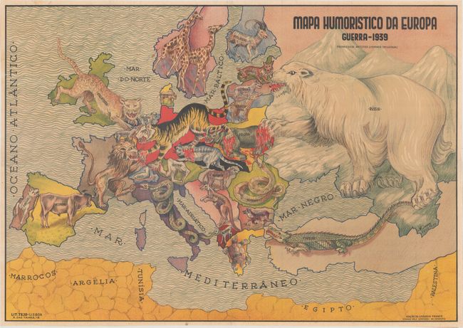
MapMaker: |
Antonio Soares
|
|
| |
| |
Subject: |
Europe, WWII |
|
| |
Period/Size: |
1939 / 17.8" x 25.2" (45.3 x 64.0 cm)
|
|
| |
Color: |
Colored
|
|
| |
Condition: |
(B+) Issued folding, now flattened and backed on thin archival tissue to repair some tiny separations along the folds. There are two very small holes along the folds (one in the North Sea and one in the Mediterranean) that have been professionally repair (condition help) |
|
| |
Source: |
|
|
| |
References: |
|
|
| |
|
|
| Sales Information |
| |
| |
Price: |
|
|
| |
| |
Offered by: |
Old World Auctions |
|
| |
Catalog: |
Auction No. 172 - Antique Maps, Charts, Atlases & Globes (9470) |
|
| |
Lot/Item #: |
385 |
|
| |
| |
Date: |
04/2019
|
|
| |
| |
|