| Item Detail |
| |
| |
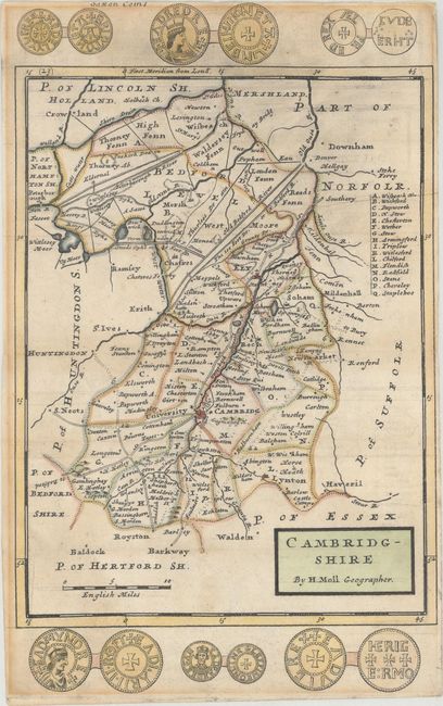
MapMaker: |
Herman Moll
|
|
| |
| |
Subject: |
Eastern England |
|
| |
Period/Size: |
1730 / 12.3" x 7.5" (31.3 x 19.1 cm)
|
|
| |
Color: |
Colored
|
|
| |
Condition: |
(B+) Issued folding, with light offsetting and toning. There are remnants of hinge tape on verso. Narrow margins, as issued. (condition help) |
|
| |
Source: |
A Set of Fifty New and Correct Maps of England and Wales, &c. |
|
| |
References: |
Shirley (BL Atlases) T.MOLL-6d. |
|
| |
|
|
| Sales Information |
| |
| |
Price: |
|
|
| |
| |
Offered by: |
Old World Auctions |
|
| |
Catalog: |
Auction No. 172 - Antique Maps, Charts, Atlases & Globes (9470) |
|
| |
Lot/Item #: |
393 |
|
| |
| |
Date: |
04/2019
|
|
| |
| |
|