| Item Detail |
| |
| |
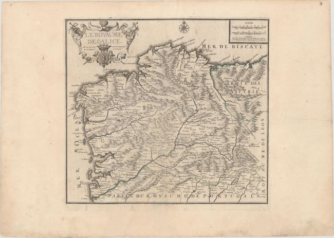
MapMaker: |
Nicolas de Fer
|
|
| |
| |
Subject: |
Northwestern Spain |
|
| |
Period/Size: |
1708 / 17.0" x 18.6" (43.2 x 47.3 cm)
|
|
| |
Color: |
Black & White
|
|
| |
Condition: |
(B+) On a watermarked sheet with wide margins and professional repairs to two tears that extend 3.5" and 1.25" at bottom. There are a few faint spots of foxing and light printer's ink residue. (condition help) |
|
| |
Source: |
Atlas ou Recueil de Cartes Geographiques… |
|
| |
References: |
Pastoureau, FER II C [71]. |
|
| |
|
|
| Sales Information |
| |
| |
Price: |
|
|
| |
| |
Offered by: |
Old World Auctions |
|
| |
Catalog: |
Auction No. 172 - Antique Maps, Charts, Atlases & Globes (9470) |
|
| |
Lot/Item #: |
463 |
|
| |
| |
Date: |
04/2019
|
|
| |
| |
|