Title:
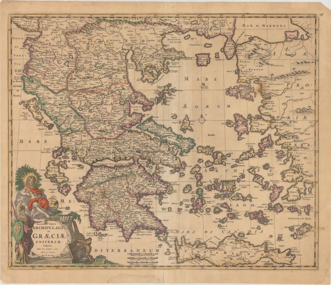
“Accurata Totius Archipelagi et Graeciae Universae Tabula...”
Map Maker:
Frederick de Wit
This is a lovely map of the Greek archipelago, ext... (full text available to subscribers)
| Item Detail |
| |
| |
MapMaker: |
Frederick de Wit
|
|
| |
| |
Subject: |
Greece |
|
| |
Period/Size: |
1680 / 17.1" x 20.9" (43.5 x 53.1 cm)
|
|
| |
Color: |
Colored
|
|
| |
Condition: |
(B+) Full contemporary color with light toning and a small stain at top right. There is both a 2.5" centerfold separation and 1.5" edge tear at bottom that have been closed on verso with hinge tape. A few extraneous creases adjacent to the centerfold ha (condition help) |
|
| |
Source: |
|
|
| |
References: |
|
|
| |
|
|
| Sales Information |
| |
| |
Price: |
|
|
| |
| |
Offered by: |
Old World Auctions |
|
| |
Catalog: |
Auction No. 172 - Antique Maps, Charts, Atlases & Globes (9470) |
|
| |
Lot/Item #: |
525 |
|
| |
| |
Date: |
04/2019
|
|
| |
| |
|
Antique Maps - Valuation and Pricing, Descriptions, Resources |
|
Home |
Information |
Search |
Register |
Contact Us |
Site Map
Americana Exchange, Inc. © 1999 - 2024 Americana Exchange, Inc.. All rights reserved.
OldMaps.com, the OldMaps.com logo and
AMPR are service marks or registered service marks of Americana Exchange, Inc..
|