| Item Detail |
| |
| |
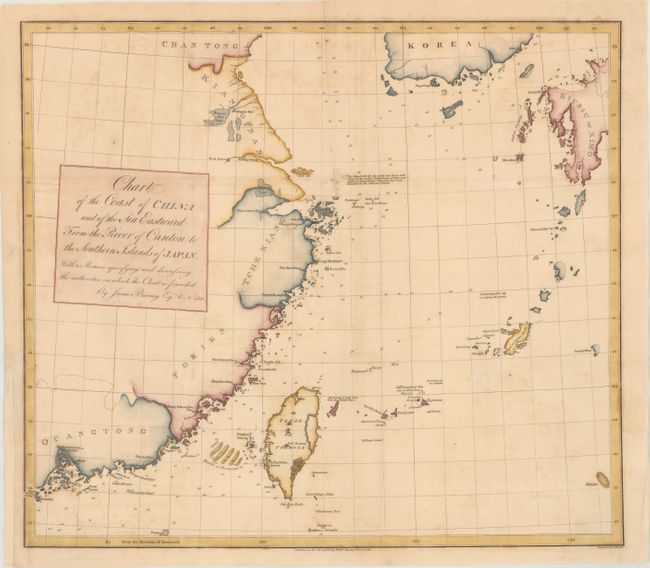
MapMaker: |
James Burney
|
|
| |
| |
Subject: |
Eastern China |
|
| |
Period/Size: |
1810 / 15.2" x 17.3" (38.6 x 44.0 cm)
|
|
| |
Color: |
Colored
|
|
| |
Condition: |
(B+) Issued folding, now flattened on paper with an "1810" and "HS" watermarks. There is minor toning and offsetting along with light foxing. A binding trim at left has been professionally replaced with old paper to accommodate framing. (condition help) |
|
| |
Source: |
Chronological History of the Discoveries in the South Sea or Pacific Ocean |
|
| |
References: |
|
|
| |
|
|
| Sales Information |
| |
| |
Price: |
|
|
| |
| |
Offered by: |
Old World Auctions |
|
| |
Catalog: |
Auction No. 172 - Antique Maps, Charts, Atlases & Globes (9470) |
|
| |
Lot/Item #: |
638 |
|
| |
| |
Date: |
04/2019
|
|
| |
| |
|