Title:
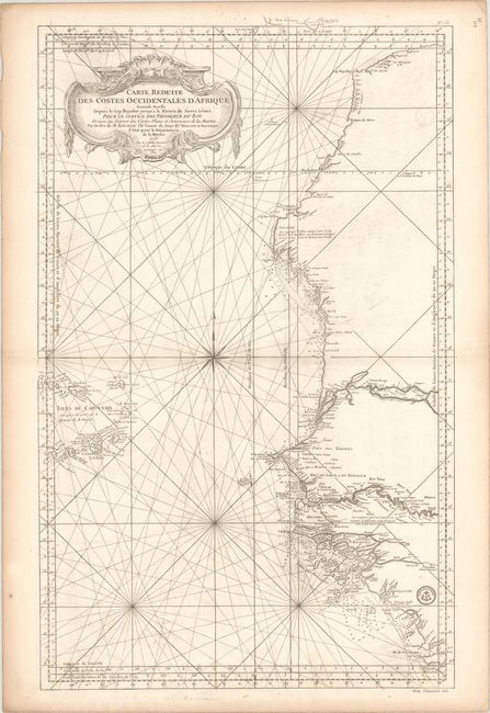
“Carte Reduite des Costes Occidentales d'Afrique Seconde Feuille Depuis le Cap Bojador Jusqu'a la Riviere de Sierra Leona Pour le Service des Vaisseaux du Roy…”
Map Maker:
Jacques Nicolas Bellin
This large nautical chart of the West African coas... (full text available to subscribers)
| Item Detail |
| |
| |
MapMaker: |
Jacques Nicolas Bellin
|
|
| |
| |
Subject: |
Western Africa |
|
| |
Period/Size: |
1765 / 34.7" x 21.5" (88.2 x 54.7 cm)
|
|
| |
Color: |
Black & White
|
|
| |
Condition: |
(B+) A dark impression on watermarked paper with light offsetting and minor foxing at bottom. There is light toning along the sheet edges. (condition help) |
|
| |
Source: |
|
|
| |
References: |
|
|
| |
|
|
| Sales Information |
| |
| |
Price: |
|
|
| |
| |
Offered by: |
Old World Auctions |
|
| |
Catalog: |
Auction No. 172 - Antique Maps, Charts, Atlases & Globes (9470) |
|
| |
Lot/Item #: |
691 |
|
| |
| |
Date: |
04/2019
|
|
| |
| |
|
Antique Maps - Valuation and Pricing, Descriptions, Resources |
|
Home |
Information |
Search |
Register |
Contact Us |
Site Map
Americana Exchange, Inc. © 1999 - 2024 Americana Exchange, Inc.. All rights reserved.
OldMaps.com, the OldMaps.com logo and
AMPR are service marks or registered service marks of Americana Exchange, Inc..
|