| Item Detail |
| |
| |
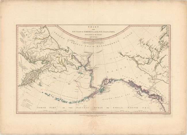
MapMaker: |
William Faden
|
|
| |
| |
Subject: |
North Pacific Ocean |
|
| |
Period/Size: |
1808 / 15.4" x 27.0" (39.2 x 68.6 cm)
|
|
| |
Color: |
Colored
|
|
| |
Condition: |
(B+) A nice impression with a hint of offsetting and a light damp stain concentrated along the bottom of the centerfold. There are short edge tears confined to the wide blank margins and an archivally repaired centerfold separation that enters 2.5" into (condition help) |
|
| |
Source: |
General Atlas |
|
| |
References: |
Kershaw #1192. |
|
| |
|
|
| Sales Information |
| |
| |
Price: |
|
|
| |
| |
Offered by: |
Old World Auctions |
|
| |
Catalog: |
Auction No. 172 - Antique Maps, Charts, Atlases & Globes (9470) |
|
| |
Lot/Item #: |
697 |
|
| |
| |
Date: |
04/2019
|
|
| |
| |
|