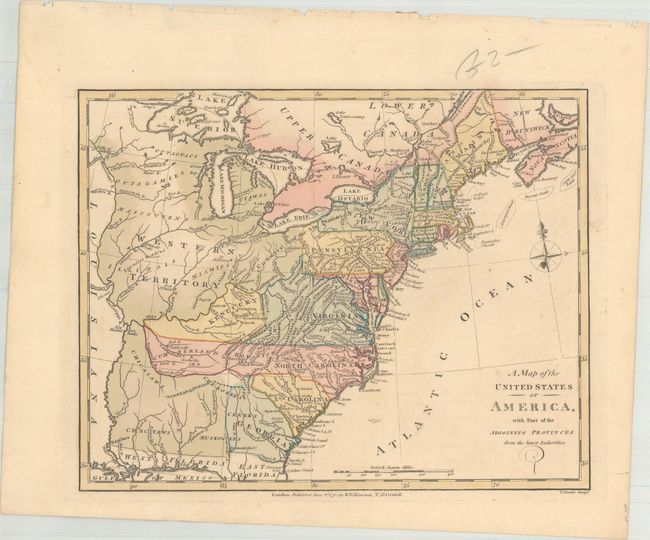
Title:
“A Map of the United States of America, with Part of the Adjoining Provinces from the Latest Authorities”
Map Maker:
Robert Wilkinson
This uncommon map presents a pre-Tennessee conf... (full text available to subscribers)
| Item Detail |
| |
| |
MapMaker: |
Robert Wilkinson
|
|
| |
| |
Subject: |
Eastern United States |
|
| |
Period/Size: |
1794 / 8.5" x 10.8" (21.6 x 27.5 cm)
|
|
| |
Color: |
Colored
|
|
| |
Condition: |
(A) Original color with some minor soiling. (condition help) |
|
| |
Source: |
General Atlas |
|
| |
References: |
Shirley (BL Atlases) T.WILK-1a #46. |
|
| |
|
|
| Sales Information |
| |
| |
Price: |
|
|
| |
| |
Offered by: |
Old World Auctions |
|
| |
Catalog: |
Auction No. 173 - Antique Maps, Charts, Atlases & Globes (9471) |
|
| |
Lot/Item #: |
82 |
|
| |
| |
Date: |
06/2019
|
|
| |
| |
|
Antique Maps - Valuation and Pricing, Descriptions, Resources |
|
Home |
Information |
Search |
Register |
Contact Us |
Site Map
Americana Exchange, Inc. © 1999 - 2024 Americana Exchange, Inc.. All rights reserved.
OldMaps.com, the OldMaps.com logo and
AMPR are service marks or registered service marks of Americana Exchange, Inc..
|