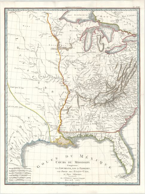
Title:
“Cours du Mississipi Comprenant la Louisiane, les 2 Florides, une Partie des Etats-Unis et Pays Adjacents”
Map Maker:
Jean Baptiste Poirson
This rare map focuses on the course of the Mississ... (full text available to subscribers)
| Item Detail |
| |
| |
MapMaker: |
Jean Baptiste Poirson
|
|
| |
| |
Subject: |
Central United States |
|
| |
Period/Size: |
1803 / 21.3" x 16.3" (54.1 x 41.4 cm)
|
|
| |
Color: |
Colored
|
|
| |
Condition: |
(A) A bright sheet, issued folding, with the watermark "G [heart] Fenerol Ambert" and professional repairs to a couple of minor fold separations. (condition help) |
|
| |
Source: |
Statistique Generale et Particulare de la France et ses Colonies… |
|
| |
References: |
Wheat (TMW) #257. |
|
| |
|
|
| Sales Information |
| |
| |
Price: |
|
|
| |
| |
Offered by: |
Old World Auctions |
|
| |
Catalog: |
Auction No. 173 - Antique Maps, Charts, Atlases & Globes (9471) |
|
| |
Lot/Item #: |
108 |
|
| |
| |
Date: |
06/2019
|
|
| |
| |
|
Antique Maps - Valuation and Pricing, Descriptions, Resources |
|
Home |
Information |
Search |
Register |
Contact Us |
Site Map
Americana Exchange, Inc. © 1999 - 2024 Americana Exchange, Inc.. All rights reserved.
OldMaps.com, the OldMaps.com logo and
AMPR are service marks or registered service marks of Americana Exchange, Inc..
|