Title:
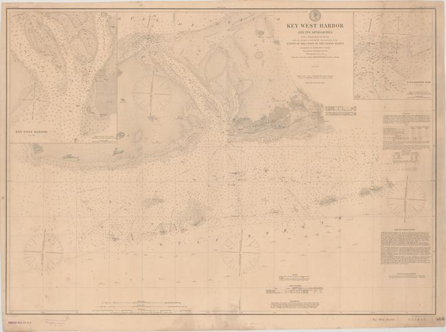
“Key West Harbor and Its Approaches from a Trigonometrical Survey...”
Map Maker:
U.S. Coast & Geodetic Survey
This is an updated version of a chart that first a... (full text available to subscribers)
| Item Detail |
| |
| |
MapMaker: |
U.S. Coast & Geodetic Survey
|
|
| |
| |
Subject: |
Key West, Florida |
|
| |
Period/Size: |
1884 / 24.6" x 34.4" (62.5 x 87.4 cm)
|
|
| |
Color: |
Black & White
|
|
| |
Condition: |
(B+) Overall light toning with some scattered minor staining. (condition help) |
|
| |
Source: |
|
|
| |
References: |
|
|
| |
|
|
| Sales Information |
| |
| |
Price: |
|
|
| |
| |
Offered by: |
Old World Auctions |
|
| |
Catalog: |
Auction No. 173 - Antique Maps, Charts, Atlases & Globes (9471) |
|
| |
Lot/Item #: |
132 |
|
| |
| |
Date: |
06/2019
|
|
| |
| |
|
Antique Maps - Valuation and Pricing, Descriptions, Resources |
|
Home |
Information |
Search |
Register |
Contact Us |
Site Map
Americana Exchange, Inc. © 1999 - 2024 Americana Exchange, Inc.. All rights reserved.
OldMaps.com, the OldMaps.com logo and
AMPR are service marks or registered service marks of Americana Exchange, Inc..
|