Title:
“Atlas of the State of Maine Including Statistics and Descriptions of Its History, Educational System, Geology, Rail Roads Natural Resources, Summer Resorts and Manufacturing Interests…”
Map Maker:
George N. Colby
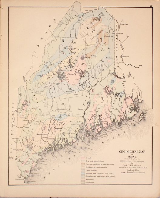
This disbound atlas of the state contains a wealth... (full text available to subscribers)
| Item Detail |
| |
| |
MapMaker: |
George N. Colby
|
|
| |
| |
Subject: |
Atlases, Maine |
|
| |
Period/Size: |
1884 / 17.3" x 14.2" (44.0 x 36.1 cm)
|
|
| |
Color: |
Colored
|
|
| |
Condition: |
(B+) Condition code is for the maps, which are generally very good with uniform pleasant light toning and occasional edge chips confined to the far blank margins. The large folding map of the state has a number of short fold separations and one tear at l (condition help) |
|
| |
Source: |
|
|
| |
References: |
|
|
| |
|
|
| Sales Information |
| |
| |
Price: |
|
|
| |
| |
Offered by: |
Old World Auctions |
|
| |
Catalog: |
Auction No. 173 - Antique Maps, Charts, Atlases & Globes (9471) |
|
| |
Lot/Item #: |
139 |
|
| |
| |
Date: |
06/2019
|
|
| |
| |
|
Antique Maps - Valuation and Pricing, Descriptions, Resources |
|
Home |
Information |
Search |
Register |
Contact Us |
Site Map
Americana Exchange, Inc. © 1999 - 2024 Americana Exchange, Inc.. All rights reserved.
OldMaps.com, the OldMaps.com logo and
AMPR are service marks or registered service marks of Americana Exchange, Inc..
|