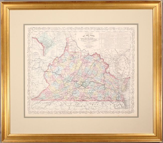
Title:
“A New Map of the State of Virginia Exhibiting its Internal Improvements Roads Distances &c.”
Map Maker:
Charles Desilver
This attractive map has the imprint of Charles Des... (full text available to subscribers)
| Item Detail |
| |
| |
MapMaker: |
Charles Desilver
|
|
| |
| |
Subject: |
Virginia & West Virginia |
|
| |
Period/Size: |
1856 / 12.6" x 15.6" (32.0 x 39.7 cm)
|
|
| |
Color: |
Colored
|
|
| |
Condition: |
(A) Original color on a bright sheet with a minor spot in the left blank margin and light toning along the edges of the sheet. Several of the routes on the map have been lightly traced in pencil. Framed with 100% museum grade materials. Not examined ou (condition help) |
|
| |
Source: |
A New Universal Atlas... |
|
| |
References: |
|
|
| |
|
|
| Sales Information |
| |
| |
Price: |
|
|
| |
| |
Offered by: |
Old World Auctions |
|
| |
Catalog: |
Auction No. 173 - Antique Maps, Charts, Atlases & Globes (9471) |
|
| |
Lot/Item #: |
167 |
|
| |
| |
Date: |
06/2019
|
|
| |
| |
|
Antique Maps - Valuation and Pricing, Descriptions, Resources |
|
Home |
Information |
Search |
Register |
Contact Us |
Site Map
Americana Exchange, Inc. © 1999 - 2024 Americana Exchange, Inc.. All rights reserved.
OldMaps.com, the OldMaps.com logo and
AMPR are service marks or registered service marks of Americana Exchange, Inc..
|