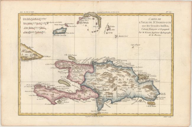
Title:
“Carte de l'Isle de St. Domingue une des Grandes Antilles, Colonie Francoise et Espagnole”
Map Maker:
Rigobert Bonne
Engraved chart of the entire island that is delica... (full text available to subscribers)
| Item Detail |
| |
| |
MapMaker: |
Rigobert Bonne
|
|
| |
| |
Subject: |
Hispaniola |
|
| |
Period/Size: |
1780 / 8.4" x 12.6" (21.4 x 32.0 cm)
|
|
| |
Color: |
Colored
|
|
| |
Condition: |
(A) A nice impression with minor printer's ink residue and light toning along the edges of the sheet. (condition help) |
|
| |
Source: |
Atlas de Toutes les Parties Connues du Globe Terrestre |
|
| |
References: |
|
|
| |
|
|
| Sales Information |
| |
| |
Price: |
|
|
| |
| |
Offered by: |
Old World Auctions |
|
| |
Catalog: |
Auction No. 173 - Antique Maps, Charts, Atlases & Globes (9471) |
|
| |
Lot/Item #: |
196 |
|
| |
| |
Date: |
06/2019
|
|
| |
| |
|
Antique Maps - Valuation and Pricing, Descriptions, Resources |
|
Home |
Information |
Search |
Register |
Contact Us |
Site Map
Americana Exchange, Inc. © 1999 - 2024 Americana Exchange, Inc.. All rights reserved.
OldMaps.com, the OldMaps.com logo and
AMPR are service marks or registered service marks of Americana Exchange, Inc..
|