Title:
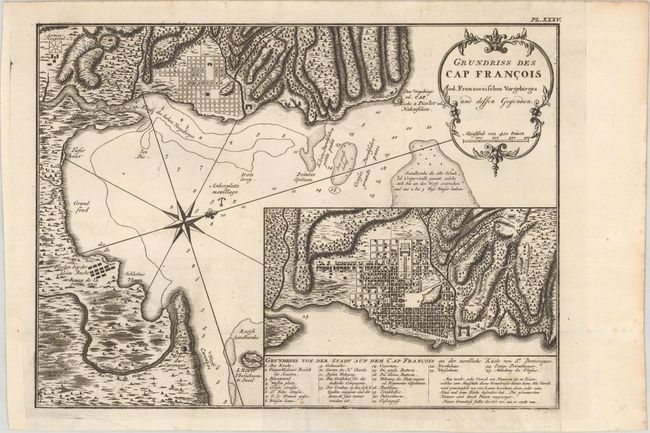
“Grundriss des Cap Francois od. Franzoesischen Vorgebirges und Dessen Gegenden”
Map Maker:
Jacques Nicolas Bellin
This is the German edition of Bellin's chart of th... (full text available to subscribers)
| Item Detail |
| |
| |
MapMaker: |
Jacques Nicolas Bellin
|
|
| |
| |
Subject: |
Cap-Haitien, Haiti |
|
| |
Period/Size: |
1760 / 9.1" x 12.3" (23.2 x 31.3 cm)
|
|
| |
Color: |
Black & White
|
|
| |
Condition: |
(A) A sharp impression on watermarked paper with minor offsetting. (condition help) |
|
| |
Source: |
|
|
| |
References: |
|
|
| |
|
|
| Sales Information |
| |
| |
Price: |
|
|
| |
| |
Offered by: |
Old World Auctions |
|
| |
Catalog: |
Auction No. 173 - Antique Maps, Charts, Atlases & Globes (9471) |
|
| |
Lot/Item #: |
197 |
|
| |
| |
Date: |
06/2019
|
|
| |
| |
|
Antique Maps - Valuation and Pricing, Descriptions, Resources |
|
Home |
Information |
Search |
Register |
Contact Us |
Site Map
Americana Exchange, Inc. © 1999 - 2024 Americana Exchange, Inc.. All rights reserved.
OldMaps.com, the OldMaps.com logo and
AMPR are service marks or registered service marks of Americana Exchange, Inc..
|