Title:
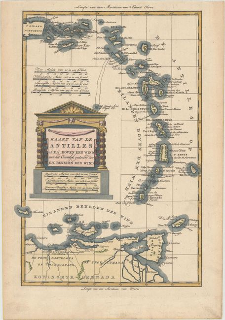
“Kaart van de Antilles of Eil. Boven den Wind met het Oostelyk Gedeelte der Eil. Beneden den Wind”
Map Maker:
Willem Albert Bachiene
A decorative map of the Lesser Antilles extending ... (full text available to subscribers)
| Item Detail |
| |
| |
MapMaker: |
Willem Albert Bachiene
|
|
| |
| |
Subject: |
Lesser Antilles |
|
| |
Period/Size: |
1785 / 12.5" x 8.5" (31.8 x 21.6 cm)
|
|
| |
Color: |
Colored
|
|
| |
Condition: |
(A) On sturdy paper with a large fleur-de-lis coat of arms and minor toning and soiling along the edges of the sheet. (condition help) |
|
| |
Source: |
Atlas tot Opheldering der Hedendaagsche Historie… |
|
| |
References: |
Shirley (BL Atlases) T.BACH-3a. |
|
| |
|
|
| Sales Information |
| |
| |
Price: |
|
|
| |
| |
Offered by: |
Old World Auctions |
|
| |
Catalog: |
Auction No. 173 - Antique Maps, Charts, Atlases & Globes (9471) |
|
| |
Lot/Item #: |
198 |
|
| |
| |
Date: |
06/2019
|
|
| |
| |
|
Antique Maps - Valuation and Pricing, Descriptions, Resources |
|
Home |
Information |
Search |
Register |
Contact Us |
Site Map
Americana Exchange, Inc. © 1999 - 2024 Americana Exchange, Inc.. All rights reserved.
OldMaps.com, the OldMaps.com logo and
AMPR are service marks or registered service marks of Americana Exchange, Inc..
|