Title:
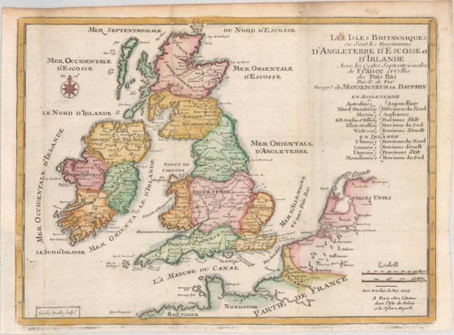
“Les Isles Britanniques ou sont les Royaumes d'Angleterre d'Escosse et d'Irlande avec les Costes Septentrionales de France et Celles des Pais Bas”
Map Maker:
Nicolas de Fer
This cleanly engraved, small map of England, Irela... (full text available to subscribers)
| Item Detail |
| |
| |
MapMaker: |
Nicolas de Fer
|
|
| |
| |
Subject: |
Britain |
|
| |
Period/Size: |
1705 / 8.2" x 11.2" (20.9 x 28.5 cm)
|
|
| |
Color: |
Colored
|
|
| |
Condition: |
(A) Issued folding on crisp sheet of watermarked paper with a couple of spots of foxing at top right and a binding trim at left that has been professionally replaced with old paper. (condition help) |
|
| |
Source: |
Petit et Nouveau Atlas |
|
| |
References: |
Pastoureau, FER XII B. |
|
| |
|
|
| Sales Information |
| |
| |
Price: |
|
|
| |
| |
Offered by: |
Old World Auctions |
|
| |
Catalog: |
Auction No. 173 - Antique Maps, Charts, Atlases & Globes (9471) |
|
| |
Lot/Item #: |
231 |
|
| |
| |
Date: |
06/2019
|
|
| |
| |
|
Antique Maps - Valuation and Pricing, Descriptions, Resources |
|
Home |
Information |
Search |
Register |
Contact Us |
Site Map
Americana Exchange, Inc. © 1999 - 2024 Americana Exchange, Inc.. All rights reserved.
OldMaps.com, the OldMaps.com logo and
AMPR are service marks or registered service marks of Americana Exchange, Inc..
|