| Item Detail |
| |
| |
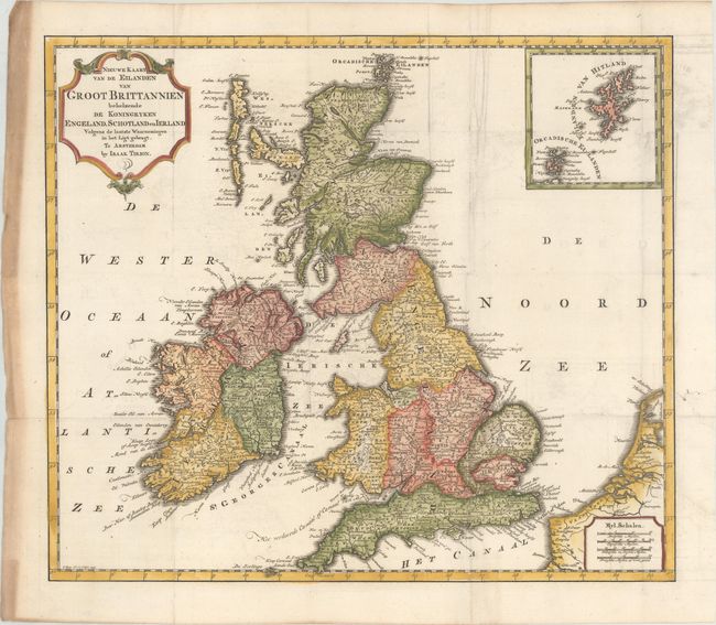
MapMaker: |
Isaac Tirion
|
|
| |
| |
Subject: |
Britain |
|
| |
Period/Size: |
1743 / 12.8" x 14.8" (32.6 x 37.6 cm)
|
|
| |
Color: |
Colored
|
|
| |
Condition: |
(A) A crisp impression issued folding on a bright sheet with faint offsetting, minor extraneous creasing, and heavy soiling along the left edge of the sheet, well away from the image. (condition help) |
|
| |
Source: |
Nieuwe en Beknopte Hand Atlas |
|
| |
References: |
|
|
| |
|
|
| Sales Information |
| |
| |
Price: |
|
|
| |
| |
Offered by: |
Old World Auctions |
|
| |
Catalog: |
Auction No. 173 - Antique Maps, Charts, Atlases & Globes (9471) |
|
| |
Lot/Item #: |
232 |
|
| |
| |
Date: |
06/2019
|
|
| |
| |
|