Title:
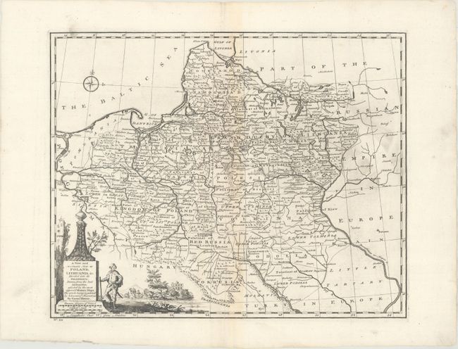
“A New and Accurate Map of Poland, Lithuania &c. Divided Into It's Palatinats...”
Map Maker:
Emanuel Bowen
This handsome map covers Poland, Lithuania, Belaru... (full text available to subscribers)
| Item Detail |
| |
| |
MapMaker: |
Emanuel Bowen
|
|
| |
| |
Subject: |
Eastern Europe |
|
| |
Period/Size: |
1747 / 13.6" x 16.9" (34.6 x 43.0 cm)
|
|
| |
Color: |
Black & White
|
|
| |
Condition: |
(B+) A nice impression with light toning along the centerfold and some printer's ink residue. (condition help) |
|
| |
Source: |
A Complete System of Geography… |
|
| |
References: |
McCorkle (18th C. Geography Books) #17-27 (Vol I); cf. Shirley (BL Atlases) T.BOW-2a #29. |
|
| |
|
|
| Sales Information |
| |
| |
Price: |
|
|
| |
| |
Offered by: |
Old World Auctions |
|
| |
Catalog: |
Auction No. 173 - Antique Maps, Charts, Atlases & Globes (9471) |
|
| |
Lot/Item #: |
307 |
|
| |
| |
Date: |
06/2019
|
|
| |
| |
|
Antique Maps - Valuation and Pricing, Descriptions, Resources |
|
Home |
Information |
Search |
Register |
Contact Us |
Site Map
Americana Exchange, Inc. © 1999 - 2024 Americana Exchange, Inc.. All rights reserved.
OldMaps.com, the OldMaps.com logo and
AMPR are service marks or registered service marks of Americana Exchange, Inc..
|