Title:
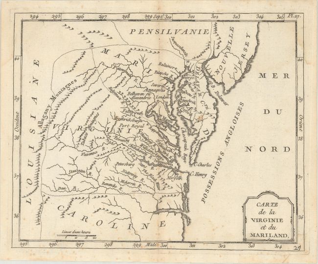
“Carte de la Virginie et du Mariland”
Map Maker:
Joseph de Laporte
This is an early edition of an uncommon map of the... (full text available to subscribers)
| Item Detail |
| |
| |
MapMaker: |
Joseph de Laporte
|
|
| |
| |
Subject: |
Colonial Mid-Atlantic United States |
|
| |
Period/Size: |
1770 / 7.0" x 8.6" (17.8 x 21.9 cm)
|
|
| |
Color: |
Black & White
|
|
| |
Condition: |
(B+) A crisp impression on watermarked paper with scattered foxing mostly at bottom. (condition help) |
|
| |
Source: |
Atlas Moderne Portatif... |
|
| |
References: |
|
|
| |
|
|
| Sales Information |
| |
| |
Price: |
|
|
| |
| |
Offered by: |
Old World Auctions |
|
| |
Catalog: |
Auction No. 175 - Antique Maps, Charts, Atlases & Globes (9482) |
|
| |
Lot/Item #: |
129 |
|
| |
| |
Date: |
11/2019
|
|
| |
| |
|
Antique Maps - Valuation and Pricing, Descriptions, Resources |
|
Home |
Information |
Search |
Register |
Contact Us |
Site Map
Americana Exchange, Inc. © 1999 - 2024 Americana Exchange, Inc.. All rights reserved.
OldMaps.com, the OldMaps.com logo and
AMPR are service marks or registered service marks of Americana Exchange, Inc..
|