Title:
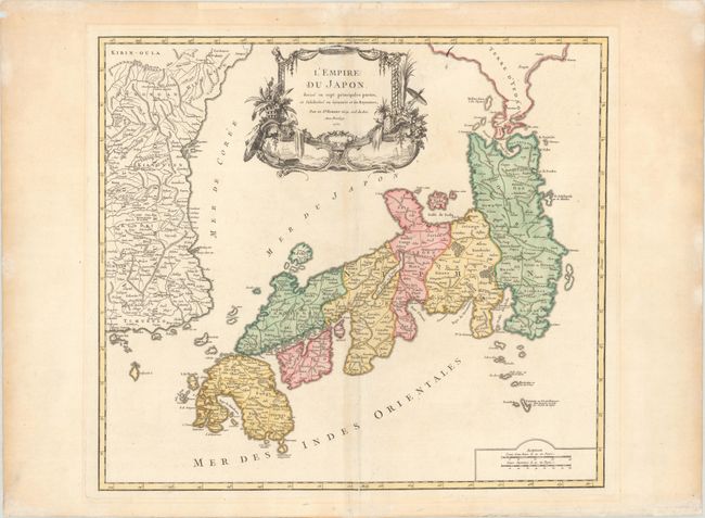
“L'Empire du Japon, Divise en Sept Principales Parties, et Subdivise en Soixante et Six Royaumes”
Map Maker:
Gilles Robert de Vaugondy
Large, finely engraved map of Japan with a distinc... (full text available to subscribers)
| Item Detail |
| |
| |
MapMaker: |
Gilles Robert de Vaugondy
|
|
| |
| |
Subject: |
Japan & Korea |
|
| |
Period/Size: |
1750 / 19.0" x 21.3" (48.3 x 54.1 cm)
|
|
| |
Color: |
Colored
|
|
| |
Condition: |
(A) On a thick sheet of watermarked paper with a hint of toning along the centerfold and a few printer's creases. There are minor paper repairs in the far blank margins, not affecting the map. (condition help) |
|
| |
Source: |
Atlas Universel |
|
| |
References: |
Hubbard #101; Walter plate #86; Pedley #410. |
|
| |
|
|
| Sales Information |
| |
| |
Price: |
|
|
| |
| |
Offered by: |
Old World Auctions |
|
| |
Catalog: |
Auction No. 175 - Antique Maps, Charts, Atlases & Globes (9482) |
|
| |
Lot/Item #: |
590 |
|
| |
| |
Date: |
11/2019
|
|
| |
| |
|
Antique Maps - Valuation and Pricing, Descriptions, Resources |
|
Home |
Information |
Search |
Register |
Contact Us |
Site Map
Americana Exchange, Inc. © 1999 - 2024 Americana Exchange, Inc.. All rights reserved.
OldMaps.com, the OldMaps.com logo and
AMPR are service marks or registered service marks of Americana Exchange, Inc..
|