Title:
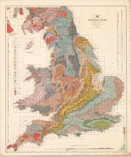
“Geological Map of England & Wales Reduced Chiefly from the Ordnance and Geological Surveys...”
Map Maker:
Archibald Geikie
This superb, large-scale thematic map covers Engla... (full text available to subscribers)
| Item Detail |
| |
| |
MapMaker: |
Archibald Geikie
|
|
| |
| |
Subject: |
England & Wales |
|
| |
Period/Size: |
1897 / 39.4" x 32.8" (100.1 x 83.4 cm)
|
|
| |
Color: |
Colored
|
|
| |
Condition: |
(A) The map image is clean and bright, with vivid color. There are a couple small damp stains and some soiling confined to the blank margins, well away from the map image. (condition help) |
|
| |
Source: |
|
|
| |
References: |
|
|
| |
|
|
| Sales Information |
| |
| |
Price: |
|
|
| |
| |
Offered by: |
Old World Auctions |
|
| |
Catalog: |
Auction No. 175 - Antique Maps, Charts, Atlases & Globes (9482) |
|
| |
Lot/Item #: |
375 |
|
| |
| |
Date: |
11/2019
|
|
| |
| |
|
Antique Maps - Valuation and Pricing, Descriptions, Resources |
|
Home |
Information |
Search |
Register |
Contact Us |
Site Map
Americana Exchange, Inc. © 1999 - 2024 Americana Exchange, Inc.. All rights reserved.
OldMaps.com, the OldMaps.com logo and
AMPR are service marks or registered service marks of Americana Exchange, Inc..
|