Title:
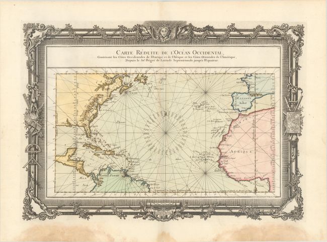
“Carte Reduite de l'Ocean Occidental, Contenant les Cotes Occidentales de l'Europe et de l'Afrique, et les Cotes Orientales de l'Amerique...”
Map Maker:
Louis Charles Desnos
This beautifully engraved chart shows the Atlantic... (full text available to subscribers)
| Item Detail |
| |
| |
MapMaker: |
Louis Charles Desnos
|
|
| |
| |
Subject: |
North Atlantic |
|
| |
Period/Size: |
1761 / 15.3" x 21.3" (38.9 x 54.1 cm)
|
|
| |
Color: |
Colored
|
|
| |
Condition: |
(B+) On watermarked paper with faint toning along the upper centerfold and dampstains confined to the bottom blank margin. (condition help) |
|
| |
Source: |
|
|
| |
References: |
|
|
| |
|
|
| Sales Information |
| |
| |
Price: |
|
|
| |
| |
Offered by: |
Old World Auctions |
|
| |
Catalog: |
Auction No. 175 - Antique Maps, Charts, Atlases & Globes (9482) |
|
| |
Lot/Item #: |
345 |
|
| |
| |
Date: |
11/2019
|
|
| |
| |
|
Antique Maps - Valuation and Pricing, Descriptions, Resources |
|
Home |
Information |
Search |
Register |
Contact Us |
Site Map
Americana Exchange, Inc. © 1999 - 2024 Americana Exchange, Inc.. All rights reserved.
OldMaps.com, the OldMaps.com logo and
AMPR are service marks or registered service marks of Americana Exchange, Inc..
|