| Item Detail |
| |
| |
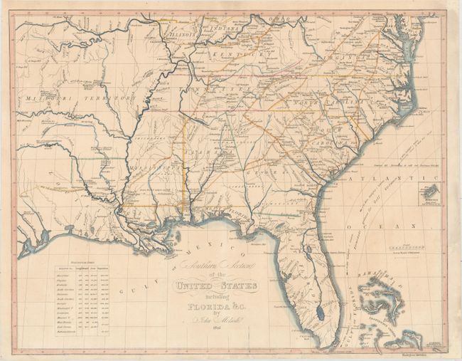
MapMaker: |
John Melish
|
|
| |
| |
Subject: |
Southern United States |
|
| |
Period/Size: |
1816 / 15.8" x 19.9" (40.2 x 50.6 cm)
|
|
| |
Color: |
Colored
|
|
| |
Condition: |
(B+) On a sheet with a "C & I. Honig" watermark. There are numerous short edge tears at bottom that have been repaired on verso with archival materials. Two chips in the top right and bottom right corners have been professionally infilled with a tiny po (condition help) |
|
| |
Source: |
Atlas til Friherre Klickowstroms Bref om de Forente Staterne |
|
| |
References: |
Phillips (Atlases) 1375-15. |
|
| |
|
|
| Sales Information |
| |
| |
Price: |
|
|
| |
| |
Offered by: |
Old World Auctions |
|
| |
Catalog: |
Auction No. 175 - Antique Maps, Charts, Atlases & Globes (9482) |
|
| |
Lot/Item #: |
146 |
|
| |
| |
Date: |
11/2019
|
|
| |
| |
|