Title:
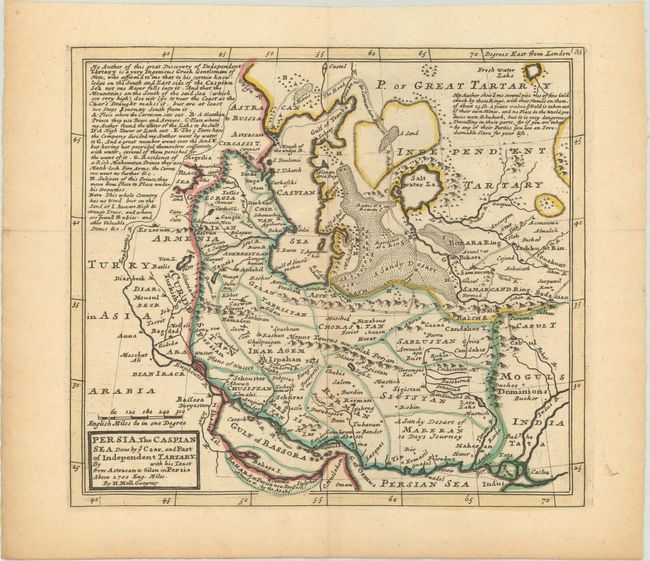
“Persia, the Caspian Sea Done by ye Czar, and Part of Independent Tartary. By with His Tract from Astracan to Gilan in Persia Above 2700 Eng. Miles”
Map Maker:
Herman Moll
This map extends from the Gulf of Bassora to the C... (full text available to subscribers)
| Item Detail |
| |
| |
MapMaker: |
Herman Moll
|
|
| |
| |
Subject: |
Persia - Iran |
|
| |
Period/Size: |
1730 / 9.2" x 10.3" (23.4 x 26.2 cm)
|
|
| |
Color: |
Colored
|
|
| |
Condition: |
(B+) Issued folding on lightly toned paper with a Pro Patria watermark and contemporary outline color. (condition help) |
|
| |
Source: |
Atlas Minor |
|
| |
References: |
|
|
| |
|
|
| Sales Information |
| |
| |
Price: |
|
|
| |
| |
Offered by: |
Old World Auctions |
|
| |
Catalog: |
Auction No. 175 - Antique Maps, Charts, Atlases & Globes (9482) |
|
| |
Lot/Item #: |
565 |
|
| |
| |
Date: |
11/2019
|
|
| |
| |
|
Antique Maps - Valuation and Pricing, Descriptions, Resources |
|
Home |
Information |
Search |
Register |
Contact Us |
Site Map
Americana Exchange, Inc. © 1999 - 2024 Americana Exchange, Inc.. All rights reserved.
OldMaps.com, the OldMaps.com logo and
AMPR are service marks or registered service marks of Americana Exchange, Inc..
|