| Item Detail |
| |
| |
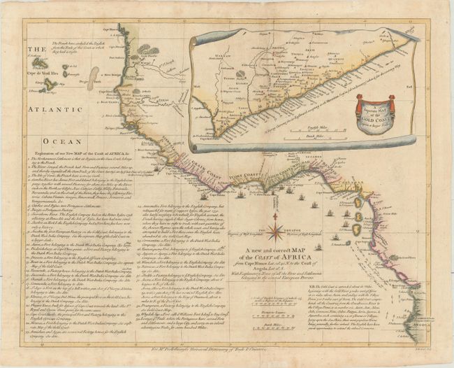
MapMaker: |
Richard William Seale
|
|
| |
| |
Subject: |
Western Africa |
|
| |
Period/Size: |
1755 / 15.0" x 18.9" (38.1 x 48.0 cm)
|
|
| |
Color: |
Colored
|
|
| |
Condition: |
(B) Issued folding, now pressed with archival repairs to a few fold separations, light soiling, and a tiny hole in an unengraved area of map in inset. (condition help) |
|
| |
Source: |
The Universal Dictionary of Trade and Commerce |
|
| |
References: |
Shirley (BL Atlases) G.POST-1a #24. |
|
| |
|
|
| Sales Information |
| |
| |
Price: |
|
|
| |
| |
Offered by: |
Old World Auctions |
|
| |
Catalog: |
Auction No. 175 - Antique Maps, Charts, Atlases & Globes (9482) |
|
| |
Lot/Item #: |
628 |
|
| |
| |
Date: |
11/2019
|
|
| |
| |
|