Rister or Sign In to see pricing information


Title:

Plan du Port du Cap dans l'Isle de St. Domingue

Map Maker:

Jacques Nicolas Bellin

Plan du Port du Cap dans l'Isle de St. Domingue

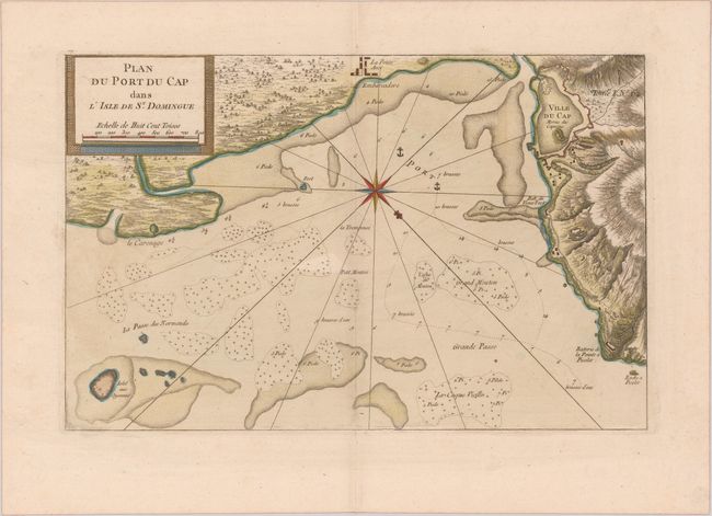
This handsome chart focuses on a piece of the coas... (full text available to subscribers)
Item Detail
 
  MapMaker:  

Jacques Nicolas Bellin


  Subject:  Cap-Haitien, Haiti  
  Period/Size:  1764 / 9.1" x 14.1"  (23.2 x 35.9 cm)  
  Color:  Colored  
  Condition:  (A) A nice impression with a hint of toning on a sheet with the Society of Jesuits watermark. (condition help)  
  Source:  Le Petit Atlas Maritime  
  References:  Sellers & Van Ee #1878-79.  
 
 
Sales Information
 
  Price: 

Please register your email to view records, or sign in with email address to see records


  Offered by:  Old World Auctions  
  Catalog:  Auction No. 175 - Antique Maps, Charts, Atlases & Globes (9482)  
  Lot/Item #:  297  
 
  Date:  11/2019  


Antique Maps - Valuation and Pricing, Descriptions, Resources


Home | Information | Search | Register | Contact Us | Site Map

Americana Exchange, Inc. © 1999 - 2024 Americana Exchange, Inc.. All rights reserved. OldMaps.com, the OldMaps.com logo and
AMPR are service marks or registered service marks of Americana Exchange, Inc..