Title:
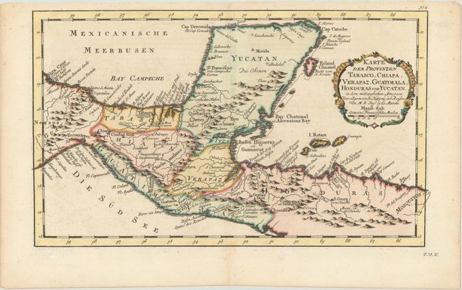
“Karte der Provinzen Tabasco, Chiapa, Verapaz, Guatimala, Honduras und Yucatan...”
Map Maker:
Jacques Nicolas Bellin
Nice detailed map of the Yucatan peninsula and nor... (full text available to subscribers)
| Item Detail |
| |
| |
MapMaker: |
Jacques Nicolas Bellin
|
|
| |
| |
Subject: |
Southern Mexico & Central America |
|
| |
Period/Size: |
1758 / 7.9" x 13.3" (20.1 x 33.8 cm)
|
|
| |
Color: |
Colored
|
|
| |
Condition: |
(A) A sharp impression on a clean, bright sheet with a hint of toning along the centerfold at bottom. (condition help) |
|
| |
Source: |
Allgemeine Historie der Reisen zu Wasser und zu Lande |
|
| |
References: |
|
|
| |
|
|
| Sales Information |
| |
| |
Price: |
|
|
| |
| |
Offered by: |
Old World Auctions |
|
| |
Catalog: |
Auction No. 175 - Antique Maps, Charts, Atlases & Globes (9482) |
|
| |
Lot/Item #: |
269 |
|
| |
| |
Date: |
11/2019
|
|
| |
| |
|
Antique Maps - Valuation and Pricing, Descriptions, Resources |
|
Home |
Information |
Search |
Register |
Contact Us |
Site Map
Americana Exchange, Inc. © 1999 - 2024 Americana Exchange, Inc.. All rights reserved.
OldMaps.com, the OldMaps.com logo and
AMPR are service marks or registered service marks of Americana Exchange, Inc..
|