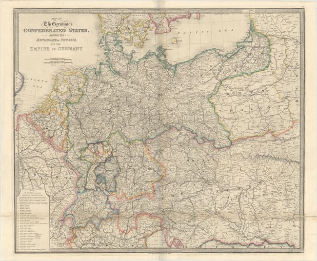
Title:
“Map of the Germanic Confederated States, Including the Kingdoms of Prussia, and the Empire of Germany”
Map Maker:
James Wyld
Very detailed, large map of Central Europe coverin... (full text available to subscribers)
| Item Detail |
| |
| |
MapMaker: |
James Wyld
|
|
| |
| |
Subject: |
Central Europe |
|
| |
Period/Size: |
1840 / 25.1" x 29.6" (63.8 x 75.2 cm)
|
|
| |
Color: |
Colored
|
|
| |
Condition: |
(B+) Contemporary color with light toning along the folds and a few short worm tracks along the central fold. (condition help) |
|
| |
Source: |
|
|
| |
References: |
|
|
| |
|
|
| Sales Information |
| |
| |
Price: |
|
|
| |
| |
Offered by: |
Old World Auctions |
|
| |
Catalog: |
Auction No. 175 - Antique Maps, Charts, Atlases & Globes (9482) |
|
| |
Lot/Item #: |
443 |
|
| |
| |
Date: |
11/2019
|
|
| |
| |
|
Antique Maps - Valuation and Pricing, Descriptions, Resources |
|
Home |
Information |
Search |
Register |
Contact Us |
Site Map
Americana Exchange, Inc. © 1999 - 2024 Americana Exchange, Inc.. All rights reserved.
OldMaps.com, the OldMaps.com logo and
AMPR are service marks or registered service marks of Americana Exchange, Inc..
|